49.3970° N · 0.9889° WPointe du Hoc
Interactive map
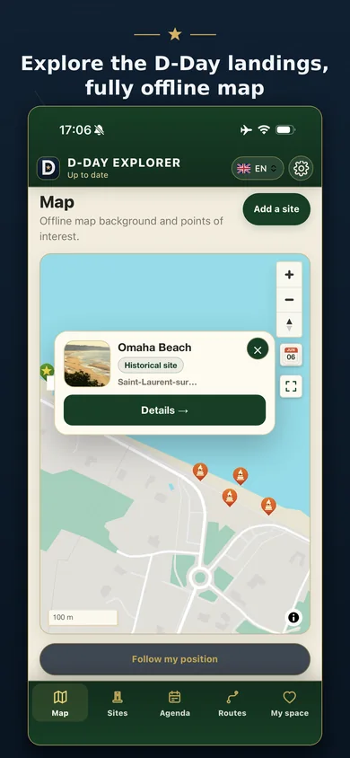
Locate D-Day beaches, museums, batteries, bunkers, cemeteries, bridges, battle sites and unit-related places from a clear mobile map.
Normandy field guide · 1944–today
D-Day Explorer brings more than 1,600 historical site sheets and the landscape of the Normandy landings onto your phone: museums, bunkers, cemeteries, routes, events and practical field information in one map-led experience.

Map · Memory · Route
The app is designed as a field companion, not just a directory. Each function helps you move from map point to historical context.
Five steps, five real places — coordinates you can check on the map.
49.3970° N · 0.9889° WPointe du Hoc
Locate D-Day beaches, museums, batteries, bunkers, cemeteries, bridges, battle sites and unit-related places from a clear mobile map.
49.3586° N · 0.8540° WNormandy American Cemetery · Colleville-sur-Mer
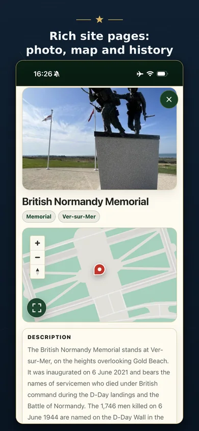
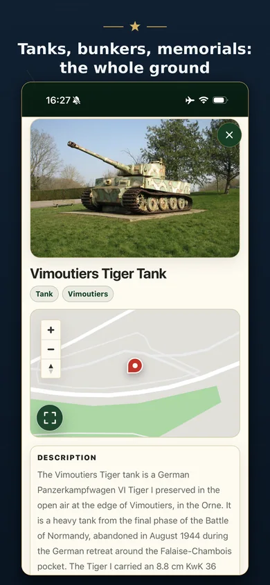
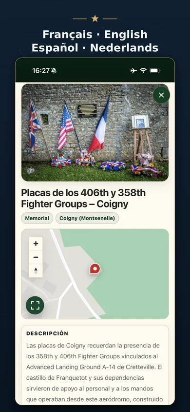
Open concise, structured sheets with location, category, description, photos and useful visit context.
49.3397° N · 0.6219° WArromanches-les-Bains
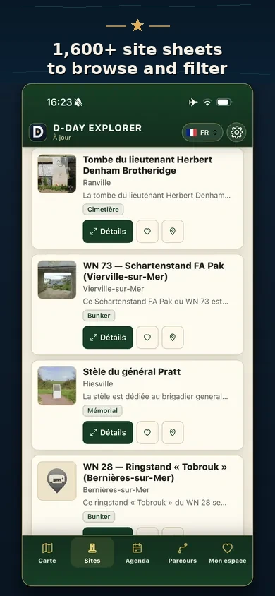
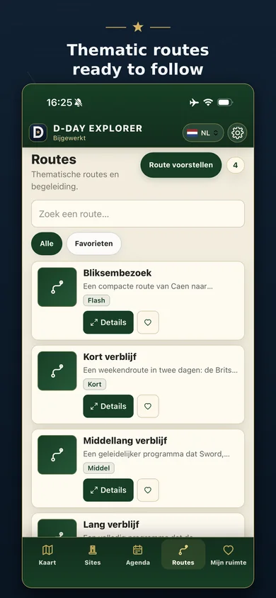
Browse every sheet with list view, search and filters: towns, categories, beaches and units.
49.4086° N · 1.3164° WSainte-Mère-Église
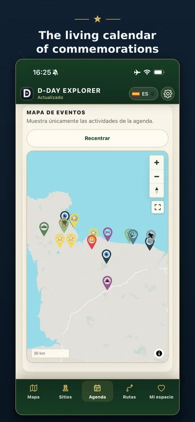
Follow ceremonies, memorial events and commemorative gatherings linked to the Normandy campaign.
49.2425° N · 0.2744° WPegasus Bridge · Bénouville
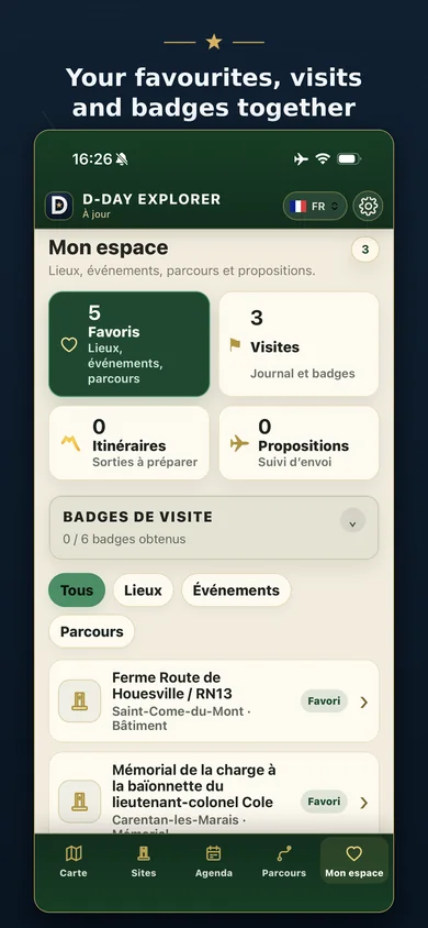
Save favourites, track visits and badges, build itineraries and follow your proposals.
D-Day Overlord ecosystem
D-Day Explorer is the mobile extension of the long-running D-Day Overlord project: focused, documented, field-oriented and built for remembrance.
Content is built around historical places and practical context, not generic travel listings.
Modern visit information is combined with wartime memory, photographs and battlefield geography.
GPS, nearby places, favorites and offline access make it useful while travelling through Normandy.
Save places, track visits and build a personal connection with the sites you discover.
The app supports French, English, Spanish and Dutch so more visitors can understand the same history.
Visitors can suggest corrections or additions, with moderation before publication.
App screenshots
Map, site sheets, routes and the events calendar as they appear in the field.
Visitors · Teachers · Guides
Yes. D-Day Explorer is presented as a free mobile app on iOS and Android.
It is a field companion: use it to locate, understand and organize your visit, while still respecting local signage, museums and guides.
The app includes offline-oriented map and content features, useful where mobile signal is weak.
French, English, Spanish and Dutch are supported in the application.
Yes. Contribution and correction flows allow users to propose improvements, subject to moderation.
Download D-Day Explorer before your next visit and turn the map into a historical itinerary.